A beautiful hiking tour takes us from Andalo to the Rifugio Pedrotti, crossing the wonderful Brenta Dolomites
Image gallery: Hike to the Pedrotti mountain hut
-
1329499003_1317821592D-0940_dolomiti-del-brenta_brenta-dolomiten.JPG
-
1329499003_1317821666D-0944_dolomiti-del-brenta_brenta-dolomiten.JPG
-
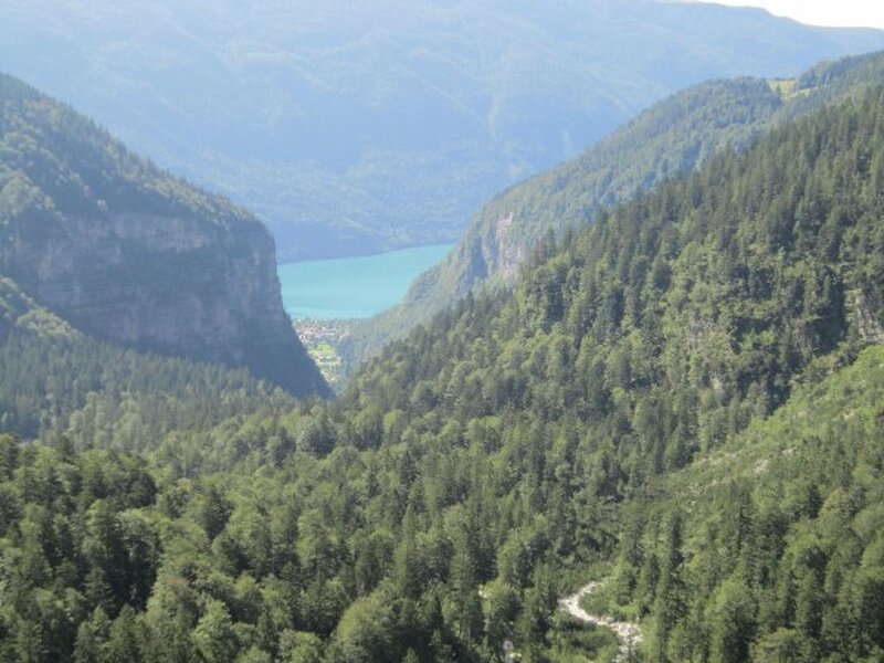
1329499003_1317821750D-0946_vista_lago_di_molveno.JPG
-
1329499003_1317821847D-0947_rifugio_croz_dell_altissimo_dolomiti-del-brenta_brenta-dolomiten.JPG
-
1329499003_1317821908D-0950_dolomiti-del-brenta_brenta-dolomiten.JPG.JPG
-
1329499003_1317821959D-0955_dolomiti-del-brenta_brenta-dolomiten.JPG
-
1329499003_1317822018D-0958_dolomiti-del-brenta_brenta-dolomiten.JPG
-
1329499003_1317822057D-0960_dolomiti-del-brenta_brenta-dolomiten_wandern_camminare.JPG
-
1329499003_1317822130D-0961_dolomiti-del-brenta_brenta-dolomiten_rifugio_tosa.JPG
-
1329499003_1317822176D-0962_dolomiti-del-brenta_brenta-dolomiten.JPG
-
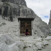
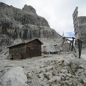
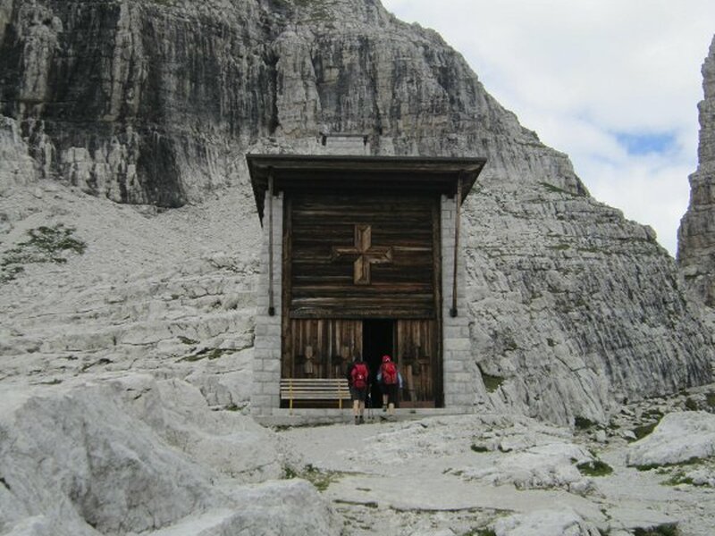
1329499003_1317822231D-0964_dolomiti-del-brenta_brenta-dolomiten_chiesetta_rifugio_pedrotti.JPG
-
1329499003_1317822296D-0967_dolomiti-del-brenta_brenta-dolomiten.JPG.JPG
-
1329499003_1317822315D-0971_dolomiti-del-brenta_brenta-dolomiten.JPG
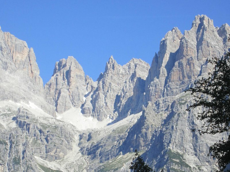
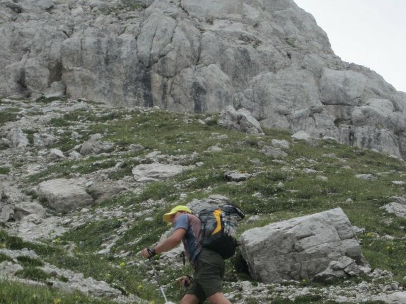
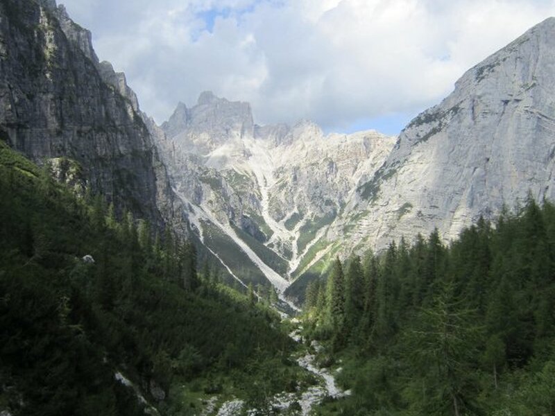
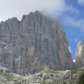
This beautiful hiking tour in the heart of the Brenta Dolomites is not very difficult but quite long and requests a good physical condition.
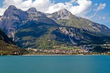
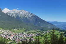
From the village of Andalo we drive to the parking space of the Parco Naturale Adamello Brenta, where we leave our car and head towards the Pradel high plateau (at 1,320 metres asl, reachable by cable car from Molveno).
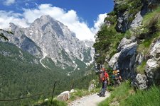
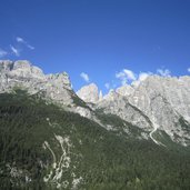
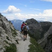
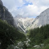
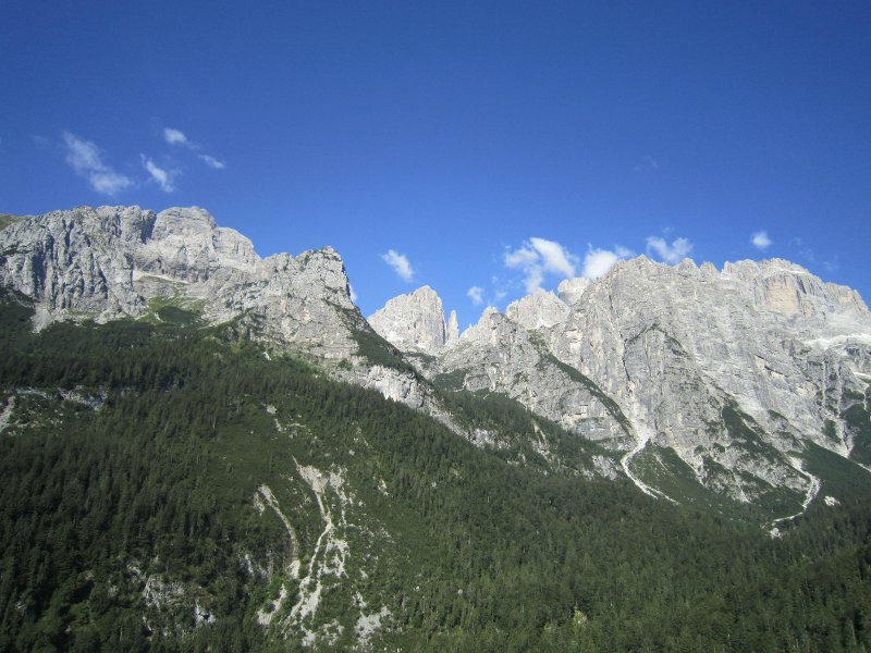
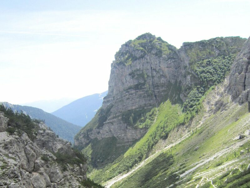
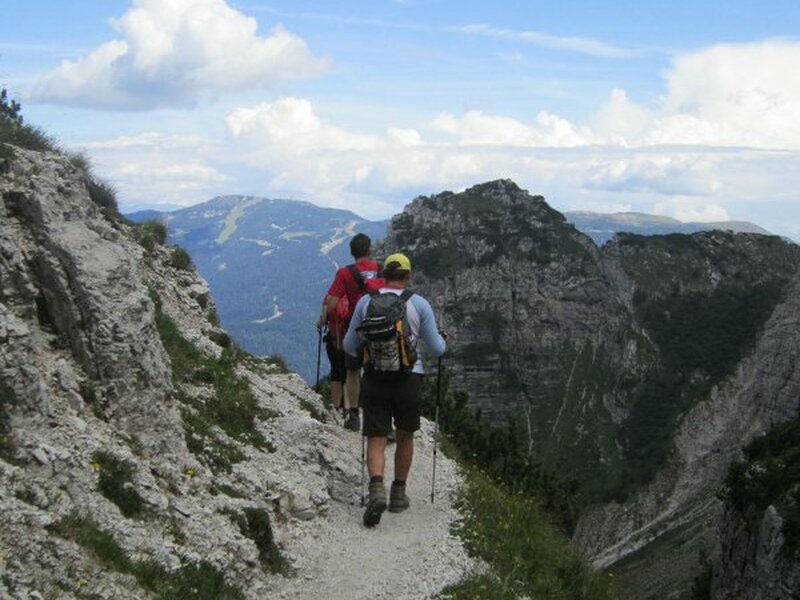
We pass the station of the cable car and follow trail no. SAT 340, which will lead us up to the Rifugio Croz dell’Altissimo (at 1,430 metres asl). The first section of the trail is quite easy and crosses the forest before it transforms itself into an exciting trail carved into the rocks and offers breathtaking views of the surrounding mountain panorama and the Valle delle Seghe.
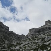
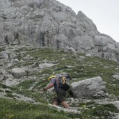
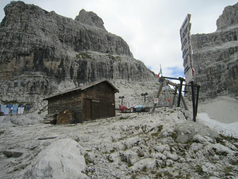
One hour and a half later we arrive at the Rifugio Croz dell’Altissimo at the foot of the homonimous mountain. We continue our tour on trail no. 340, crossing the Valle delle Seghe and the Massodi river. After further 30 minutes on the trail without any vegetation and with some exposed sections we reach the Rifugio Selvata, where we have a short rest and a nice cup of coffee. We continue our tour on trail no. SAT 319 towards our last destination, the Rifugio Pedrotti, hiking on some serpentines and stony steps near the Massodi river.
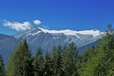
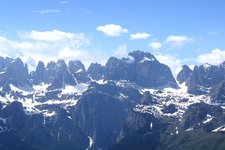
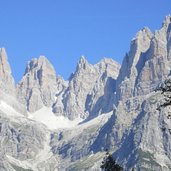
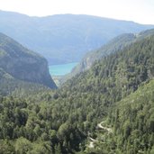
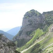
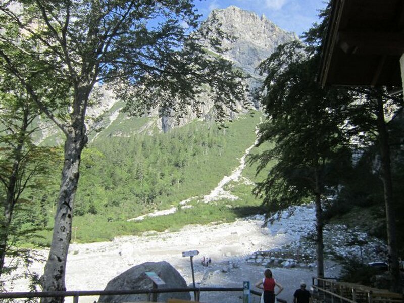
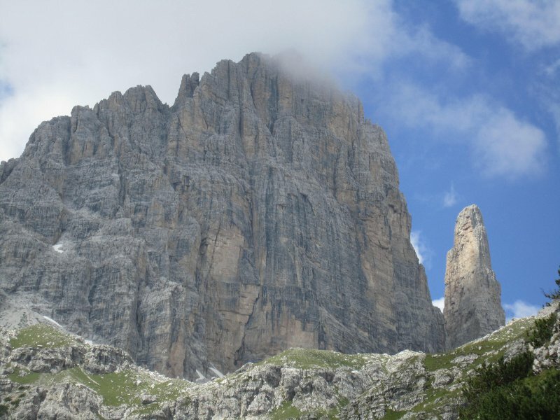
Arrived at an altitude of 1,986 metres asl we arrive at the Massodi mountain hut. From here, we can already sees the Rifugio Pedrotti, but attention: it is still much further away than it seems! In fact, we need another hour and 30 minutes until we finally get there. Hiking from the Rifugio to the near small lake (which has been empty for a long time) we enjoy great views of the surrounding mountain panorama: Mount Brenta Bassa and Mount Brenta Alta, Mount Campanil Alto and Mount Campanil Basso, Mount Torre del Brenta…
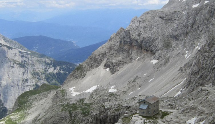
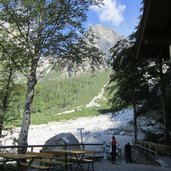
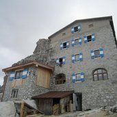
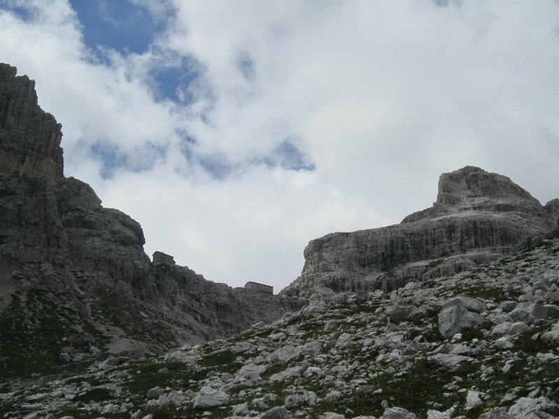
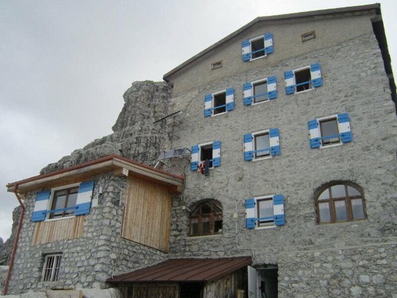
After a rather flat section we continue our hiking tour upwards to the Rifugio Tosa (2,439 metres asl) and finally to the Rifugio Pedrotti (2,491 metres asl). Arrived at our last destination, we enjoy a very tasty lunch and the wonderful mountain panorama right in front of us. Finally, we hike back down to our starting point on the same way. The Rifugio Pedrotti offers sleeping accommodation and is the perfect starting point for many hiking tours in the Brenta mountain group.
Path SAT 319: currently not accessible
Author: EC
If you want to do this mountain tour, please take information about the current conditions on site!
Starting point: Andalo, parking space of the Parco Naturale Adamello Brenta
Signposts: SAT 340, SAT 319 (currently not accessible)
Walking time: 4 - 5 hours
Altitude difference: approx. 1,200 m
Altitude level: between 1,100 and 2,491 m asl
Experienced in: July 2011