The Marmolada - the Queen of the Dolomites
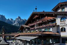
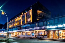
Image gallery: Marmolada
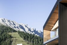
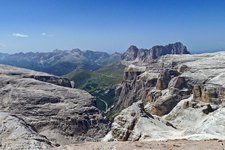
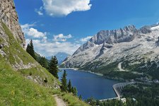
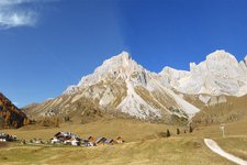
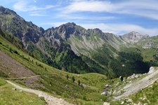
With a height of 3,343 m, the Marmolada is the highest elevation of the Dolomites. Its highest peak is the Punta Penia (3,343). The Marmolada rises between the Val di Fassa in Trentino and the Val Cordevole in the province of Belluno. These areas are reachable via the roads to Passo Pordoi between Canazei and Arabba and Passo Fedaia between Alba di Canazei and the Agordino. Unlike the majority of the Dolomites, the Marmolada is not composed of dolostone but of grey limestone. This impressive terrace at the centre of the Dolomites (also known as Monti Pallidi) strikes visitors with a seemingly endless view, enriched by the highest glacier of the Dolomites, where, until a few years ago, skiing was possible even in summer.
This mountain has two sides: at the foot of its steep southern face are the historic Val Contrin and the Valle Ombretta with an impressive, more than four kilometres wide and up to 1,000 m high rock wall. The northern side is less steep and overlooks Lago Fedaia and the spur of Porta Vescovo with the slopes of the Sasso delle Undici and the Sasso delle Dodici, which were shaped during the formation of the glacier. The long summit ridge with the main peaks (all with a height of more than 3,000 m a.s.l.) is situated between the two slopes and includes Punta Pizzo Serauta, Punta Rocca, Punta Ombretta, Punta Penia and the Gran Vernel and Piccolo Vernel that are separated by the pass.
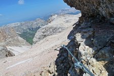
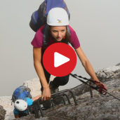
Despite being an easily accessible tourist highlight thanks to the cable car to Malga Ciapela and to the peak of Punta Rocca, the Marmolada should be ascended only by experienced and well-trained alpinists and hikers. On the southern side of the Marmolada you can find challenging paths, such as the famous "Attraverso il Pesce" of Igor Koller and Jindrich Sustr, which were created and completed several times by professional climbers from all over the world. Long and challenging routes run along the ridges on the glacier and this is exactly where two well-known vie ferrate begin: one from the Western ridge to Punta Penia and the Brigata Cadore (or Ferrata Eterna) via ferrata to the Punta Serauta on the Eastern crest. The latter was officially closed down in 2005 and even though it is still completed by some hikers, we do not recommend you to do alike, as it is not maintained anymore. Even if the vie ferrate of the Marmolada are not particularly difficult from a technical point of view, they should never be underestimated nor tackled in uncertain weather conditions. Due to its high altitude, length, lack of escape routes and the mandatory return journey on the glacier, it is considered an adventure and an exclusive prerogative for experienced, well-trained and well-equipped alpinists (a rope, an ice axe and traction cleats are essential).
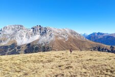
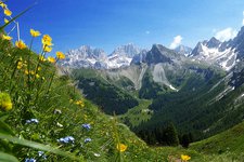
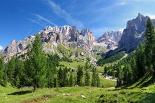
On the surrounding peaks of the Marmolada (Sasso Vernale, Cima Ombretta and Cima dell'Uomo) start numerous hiking trails, including a stage of the Alta via delle Dolomiti no. 2 which leads from Bressanone to Feltre, offering a stunning view of the Queen of the Dolomites from below.
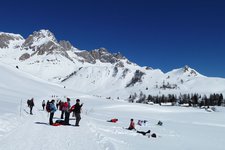
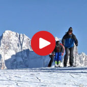
In winter, the Marmolada is connected to the Arabba skiing area (along the Sella Ronda ski circuit) in the heart of the Dolomiti Superski ski carousel. Winter sports lovers will find a paradise with the longest ski slope of the Dolomites which descends from Punta Rocca at 3,269 m a.s.l. to Malga Ciapela at 1,446 m a.s.l. with a total drop of more than 1,800 m a.s.l. and a length of 12 km. Various mountaineering paths with no equals in terms of beauty and appeal wind along this mountain.
Highest peak: Marmolada (3,343 m)
First ascent Marmolada: 28th September 1864, Paul Grohmann
Main peaks: Punta Penia (3,343 m), Punta Rocca (3,309 m), Punta Ombretta (3,230 m), Monte Serauta (3,069 m), Pizzo Serauta (3,035 m)
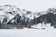
Mountain huts in this area:
- rifugio Capanna al Ghiacciaio
- rifugio Capanna Punta Penia
- rifugio E. Castiglioni alla Marmolada
- rifugio Contrin
- rifugio O. Faliér
- rifugio Fedaia
- rifugio Serauta