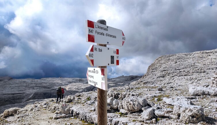
Today’s hike starts in the Val Lasties in Trentino and leads us to the Forcella Pordoi and the Forcella d’Antersass via the rifugio Boè where we stop for a break
Image gallery: Mountain tour Pordoi Saddle and Antersass Saddle


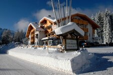
Our starting point is the rifugio Monti Pallidi in Pian de Schiavaneis along the road between Canazei and the Sella Pass. The Dolomites are also known as the "Monti Pallidi" (pale mountains) because of their pale colour. Initially, we follow the signpost to the Piz Poè, we walk around the Schiavaneis restaurant and continue along the unmarked path which ascends through the forest. After having covered a high plateau and a short section along the "Cascate" path we take path no. 647 towards the Val Lasties. This trail crosses the forest in a steep ascent before proceeding along the rock walls until the Pian de Siela.
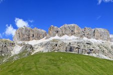
We are far beyond 2,000 metres of altitude and stop to admire the impressive view of the Col Rodella, the Sassoloungo group and the Sella Group. The view is simply amazing! We continue hiking along path no. 647 towards the rifugio Boè. This route is characterised by both slightly steep and hilly sections and we follow it until a crossroads towards the rifugio Forcella Pordoi where we follow an unmarked path until the Valon di Fos, the Forcella Pordoi and the mountain hut.
Our next destination is the rifugio Boè. The entire high plateau of the Gruppo Sella and the Piz Boè extend right in front of us. This area with its moonscape-like landscape really gets us. We then take path no. 627 and after a 45-minute walk we arrive at the rifugio Boè. At these altitudes the weather changes rapidly and as we enter the hut it is snowing, however, as we leave it the sun is shining. We take path no. 647 and reach a fork from where the trail no. 647 to the Forcella d'Antersass and the easy via ferrata surrounding the peak (path no. 647A) start.
We choose the second option and reach the Cima d'Antersass after only 15 minutes of walking. The Passo Pordoi, the Sella group and the spectacular Fanes area extend in front of us. A rather flat section takes us to the Val Lasties and the Pian Schiavaneis. Then the path ascends along a steep scree field to the Plan de Roces. Soon we encounter the signpost Forcella Pordoi again. We retrace our steps to the Pian de Sela.
Route no. 656 descends to a mountain brook in steep switchbacks. We cross the brook to the right and continue hiking until a crossroads without signposts where we keep to the left. We cross a forest and a scree field before reaching some waterfalls. Now we are in the final section of today's 6-hour hike.
Please note: sure-footedness and mountain experience are highly recommended as some paths are difficult and characterised by particularly steep sections. Another excursion in this area is the alpine tour from Mt. Sass Pordoi to Piz Boé.
Authors: Elena & Luca
Experienced in: August 2021
Last updated in: 2025
-
- Starting point:
- Monti Pallidi Hut, Pian Schiavaneis (1,849 m a.s.l.)
-
- Overall time:
- 06:00 h
-
- Total route length:
- 18,8 km
-
- Altitude:
- from 1.849 m to 2.896 m
-
- Altitude difference (uphill | downhill):
- +1138 m | -1138 m
-
- Signposts:
- "Piz Boè", "Cascate", 647, 627, 647A, 656
-
- Destination:
- Pordoi Ridge (2,848 m a.s.l.) and Antersass Ridge (2,839 m a.s.l.)
-
- Resting points:
- Monti Pallidi Hut (starting point), Forcella Pordoi Hut, Boè Hut
-
- Recommended time of year:
- Jan Feb Mar Apr May Jun Jul Aug Sep Oct Nov Dec
-
- Download GPX track:
- Mountain tour Pordoi Saddle and Antersass Saddle
-
- More information:
- The overall time shown above refers to the walking time only, not including breaks.
If you want to undertake this hike, we recommend you to check the weather and trail conditions in advance and on site before setting out.