Today’s hike leads us through the Val Duron which connects the Alpe di Siusi with the Val di Fassa
Image gallery: May hike in the Val Duron


We drive to Campitello di Fassa, a famous holiday destination, and continue to the entrance of the Val Duron (Streda de Salin). This valley in the Dolomites owes its name to the eponymous brook flowing across it. We park our car and ascend along a steep forest road.
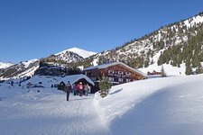
After a 10-minute uphill walk a flatter section awaits us. We continue until a fork where we follow the signposts "Val Duron" to our left. Having covered an other ascent we arrive at the rifugio Micheluzzi hut at 1,860 m a.s.l. after 30 minutes of walking. The Val Duron with its extensive network of hiking paths opens up in front of us. The valley is delimited by the Catinaccio surrounded by numerous legends in the west and the Sassolungo group in the north.
The Val Duron is a famous destination for mountain bike enthusiasts. Having passed the Micheluzzi hut we walk along the rather flat gravel path through the valley until the Baita Lino Brach hut at 1,856 m a.s.l. The hut is open both in summer and winter and delights its guests with delicious, typical dishes based on rabbit, cheese and mushrooms. The traditional gulasch with polenta, one of the most characteristic dishes of this area, is still cooked in a pot over a fire.
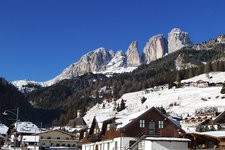
At the crossroads we take the path to the Antermoia hut, our destination and also the highest point of today's hike. For our return to the car park we walk along the opposite bank of the brook. The Val Duron delights us with stunning panoramic views of the Marmolada glacier, the highest peak of the Dolomites, the Gran Vernel, the Sasso Piatto and the Denti di Terrarossa at the end of the valley.
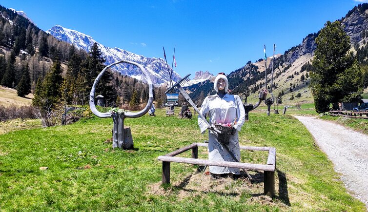
We are surrounded by verdant meadows with numerous blooming crocuses and alpine anemones. In the distance we can hear marmots whistling. Those who would like to avoid the steep ascent can take the shuttle bus from Campitello to the Micheluzzi hut available in the summer months. We recommend checking the timetable beforehand. This spring hike can be undertaken also in winter or be extended to the Giogo di Fassa.
Authors: Elena & Luca
Experienced in: May 2021
Last updated in: 2025
-
- Starting point:
- car park at the entrance to the Val Duron, Campitello di Fassa
-
- Overall time:
- 03:30 h
-
- Total route length:
- 11,0 km
-
- Altitude:
- from 1.481 m to 1.897 m
-
- Altitude difference (uphill | downhill):
- +437 m | -421 m
-
- Signposts:
- "Sentiero Val Duron", 532
-
- Destination:
- junction towards the Antermoia Mountain Hut
-
- Resting points:
- Micheluzzi Hut, Baita Lino Brach
-
- Recommended time of year:
- Jan Feb Mar Apr May Jun Jul Aug Sep Oct Nov Dec
-
- Download GPX track:
- May hike in the Val Duron
-
- More information:
- The overall time shown above refers to the walking time only, not including breaks.
If you want to undertake this hike, we recommend you to check the weather and trail conditions in advance and on site before setting out.