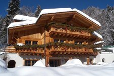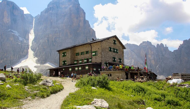
The Alberto e Maria Brentei mountain hut stands at a remarkable altitude in the Brenta Dolomites
Image gallery: Hike to the Brentei Mountain Hut


We leave Madonna di Campiglio behind us and drive to the Rifugio Vallesinella. This 4-km long road is accessible for private cars only in certain hours, otherwise it can be covered by bus (shuttle service available). We park our car on the large car park near the hut and follow path no. 317 (Rifugio Casinei) branching off to the right. We ascend some wooden and stone steps to the Rifugio Casinei at 1,825 m between the Vallesinella and the Val Brenta.
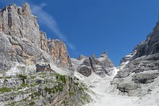
Then we follow path no. 391, also known as "Sentiero Violi" to the rifugio Brentei. This trail is definitely less-frequented than the "Sentiero Bogani" which we will take to return to the valley. Initially the "Sentiero Violi" leads slightly uphill through the impressive mountain landscape of the Brenta Dolomites. We walk across a hilly section which is secured with ropes in some spots. Having left the forest behind us we only need to cover the last 200 metres of elevation gain before arriving at the hut.
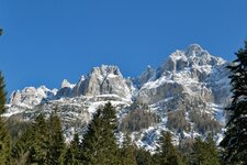
During this wonderful summer hike we can admire a marvellous view of the Crozzon del Brenta, the third highest peak of the Brenta Dolomites, and the surrounding summits. Some stunning mountain flowers blossom along the path and the meadows are covered with edelweiss flowers. The landscape is also characterised by the beautiful colours of orange and martagon lilies. At the Brentei hut we try one of the typical dishes of the hut, surrounded by the impressive Trentino mountains at 2,182 m a.s.l.
On the day of our hike the hut is still managed by Bruno Detassis, also known by his nickname "The King of the Brenta Dolomites" (il re delle Dolomiti di Brenta) who has been running this business for more than 60 years, now together with his son Claudio. We return back to our starting point and initially take path no. 318 (sentiero Bogani). While hiking along this trail we need to cross some snowfields and secured spots until we arrive at a tunnel. At the fork near rifugio Tuckett we take the path to the rifugio Casinei hut before following path no. 317B to Malga Vallesinella Alta.
We cross some bridges and boardwalks that lead us to the final section before the Vallesinella waterfalls (cascate di Vallesinella) from where we return to our starting point. Another hike in this area you should definitely not miss leads right to
the Cascate di Vallesinella and the Rifugio Tuckett hut
Authors: Elena & Luca
Experienced in: July 2019
Last updated in: 2025
-
- Starting point:
- car park at the Vallesinella Hut (1,499 m a.s.l.)
-
- Overall time:
- 06:00 h
-
- Total route length:
- 15,5 km
-
- Altitude:
- from 1.499 m to 2.191 m
-
- Altitude difference (uphill | downhill):
- +1085 m | -1085 m
-
- Signposts:
- 317, 391, 318, 317B
-
- Destination:
- Brentei Mountain Hut (2,182 m a.s.l.)
-
- Resting points:
- Vallesinella Hut, Casinei Hut, Brentei Hut
-
- Recommended time of year:
- Jan Feb Mar Apr May Jun Jul Aug Sep Oct Nov Dec
-
- Download GPX track:
- Hike to the Brentei Mountain Hut
-
- More information:
- Sure-footedness is required for this hike. The overall time shown above refers to the walking time only, not including breaks or stops at mountain huts.
If you want to undertake this hike, we recommend you to check the weather and trail conditions in advance and on site before setting out.