Today’s hike starts at the Cornisello hut and leads us to the Cornisello lakes, the Vedretta lake and Lago Nero
Image gallery: Lake hike in the Val Nambrone


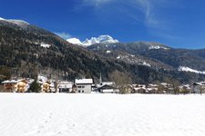
We drive through the 13-km long Val Nambrone which, together with its side valleys, forms a big triangle in the Presanella group. The valley starts in Sant'Antonio di Mavignola near Pinzolo and Madonna di Campiglio and is characterised by some narrow sections. We park our car at a gravel car park at the end of the valley.
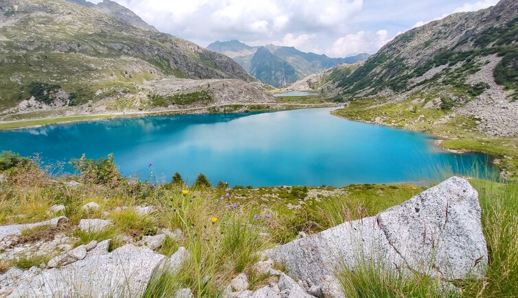
We take a forest road (signpost no. 319) to Lago di Cornisello Inferiore and reach the body of water after only 10 minutes. Soon after we arrive at Lago di Cornisello Superiore. We continue until the fork where the path to Lago di Vedretta (path no. 239) branches off. The trail runs along a slight slope which gradually steepens.
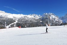
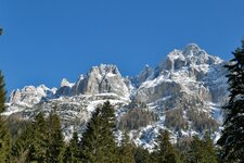
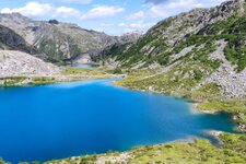
As we arrive at a small pass we stop to admire the Laghi di Cornisello at our feet, Lago Nero, our next destination, and the Brenta Dolomites on the opposite side of the valley. We ascend to Lago Vedretta immersed in the marvellous natural landscape of the Adamello Brenta Nature Park. This large, crystal-clear mountain lake at 2,628 m a.s.l. is situated in the highest point of our hike.
After a break we return to the crossroads to Lago di Vedretta. We take path no. 216 to Lago Nero branching off on the right. The impressive
Brenta Dolomites rise in the background. The red and white trail signs take us to the rifugio Cornisello and eventually to the car park. In the proximity of rifugio Cornisello, the only refreshment point of the area, we recognise the remains of some unfinished huts and a material cableway which are attributable to a construction project consisting of the construction of some never built hydropower plants.
Authors: Elena & Luca
Experienced in: July 2019
Last updated in: 2025
-
- Starting point:
- car park at the end of the Val Nambrone (2,071 m a.s.l.)
-
- Overall time:
- 04:00 h
-
- Total route length:
- 10,6 km
-
- Altitude:
- from 2.071 m to 2.628 m
-
- Altitude difference (uphill | downhill):
- +712 m | -712 m
-
- Signposts:
- 319, 239, 216
-
- Destination:
- Cornisello Lakes, Lake Vedretta and Lake Nero
-
- Resting points:
- Cornisello Hut (near the starting point)
-
- Recommended time of year:
- Jan Feb Mar Apr May Jun Jul Aug Sep Oct Nov Dec
-
- Download GPX track:
- Lake hike in the Val Nambrone
-
- More information:
- The overall time shown above refers to the walking time only, not including breaks.
If you want to undertake this hike, we recommend you to check the weather and trail conditions in advance and on site before setting out.